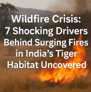
Wildfire Crisis: 7 Shocking Drivers Behind Surging Fires in India’s Tiger Habitat Uncovered
A 20-year study in central India’s Satpura Tiger Reserve reveals steep slopes and proximity to human settlements as key drivers of wildfires in tropical dry forests, while water bodies and dense road networks reduce fire risk. Researchers identified fire hotspots using satellite data (2002–2021), showing a 43% surge in blazes since 2016, with 85% occurring in the dry March–May window. Steeper terrain accelerated fire spread due to terrain-driven fuel preheating, yet many high-risk zones overlapped with tourist trails, underscoring human influence.
Areas near water experienced 35% fewer fires, acting as natural firebreaks. Surprisingly, road-dense regions saw fewer incidents, likely due to fragmented vegetation aiding containment. Climate played a pivotal role: each 1°C temperature rise spiked monthly fires by 18%, while prior-month rainfall dampened risk. The findings, critical for protecting this UNESCO-tentative site and its endangered wildlife, urge targeted patrols in high-risk zones, community collaboration to curb ignition sources, and strategic firebreaks.
As climate change lengthens dry seasons globally, the study offers a blueprint for safeguarding fire-prone tropical ecosystems.

Wildfire Crisis: 7 Shocking Drivers Behind Surging Fires in India’s Tiger Habitat Uncovered
New research spanning two decades in central India’s Satpura Tiger Reserve (STR) has unraveled the complex dance between environmental factors, human activity, and wildfires in one of the world’s most vulnerable ecosystems. The study, published in Scientific Reports, pinpoints where fires are most likely to ignite—and why—in this biodiverse landscape, offering a roadmap for smarter fire management in tropical dry forests globally.
The Burning Challenge of Dry Deciduous Forests
Tropical dry deciduous forests, like those in STR, face a silent crisis. Seasonal droughts turn lush vegetation into tinder, while human activity—from farming to tourism—adds sparks to the mix. As climate change intensifies, understanding fire patterns here isn’t just academic; it’s a race to protect habitats for endangered tigers, leopards, and countless other species.
Spanning 1,339 km² of STR’s core area, researchers analyzed 20 years of satellite fire data (2002–2021), revealing startling trends:
- Fire frequency surged by 43% in the last five years compared to earlier periods.
- Over 85% of fires erupt during March–May, the peak dry season.
Mapping the Flames: Where and Why Fires Ignite
Using advanced spatial modeling, the team identified fire hotspots and their drivers:
- Slopes: A Double-Edged Sword
Steeper terrain saw 22% more fires. While slopes naturally accelerate flames by preheating uphill vegetation, many high-risk zones overlap with tourist trails, suggesting human activity plays a role.
- Water’s Protective Embrace
Areas within 500 meters of water bodies experienced 35% fewer fires. Rivers and lakes act as natural firebreaks, dampening fuel availability.
- The Human Footprint
Proximity to settlements doubled fire likelihood, linking blazes to land-clearing for crops or foraging. Surprisingly, denser road networks correlated with fewer fires—likely because roads fragment flammable vegetation and aid firefighting access.
- Climate’s Invisible Hand
Each 1°C temperature rise increased monthly fires by 18%, while heavy rainfall in prior months reduced risk by curbing fuel dryness.
A Toolkit for Smarter Fire Management
“These findings are a game-changer for how we approach fire prevention,” explains lead author Vijay Shekhar Niyogi. Key recommendations include:
- Targeted Patrols: Focus resources on high-risk slopes and zones near villages.
- Strategic Firebreaks: Expand water-body buffers and leverage existing roads as barriers.
- Community Engagement: Work with locals to curb risky land-use practices during peak fire months.
A Window into a Warming World
The study’s temporal analysis sounds alarms: rising temperatures and erratic rainfall—hallmarks of climate change—are lengthening fire seasons. “What we’re seeing in Satpura isn’t isolated,” warns co-author Subham Banerjee. “Dry forests worldwide must adapt to this new reality.”
The Road Ahead
While the research answers critical “where” and “why” questions, unknowns remain. Future studies could explore how specific plant species fuel fires or how controlled burns might reshape risk. For now, the message is clear: protecting these ecosystems demands blending satellite insights with on-the-ground action.
As STR pursues UNESCO World Heritage status, this study equips managers with science to safeguard not just tigers, but an entire web of life threatened by humanity’s fiery footprint. In the battle against wildfires, knowledge isn’t just power—it’s prevention.
Why This Matters:
- Biodiversity Hotspot: STR shelters over 50 endangered species, including Bengal tigers and Indian giant squirrels.
- Climate Sentinel: As a bellwether for dry forests, STR’s fire patterns offer lessons for ecosystems from Brazil to Southeast Asia.
- Human Lives & Livelihoods: Wildfires threaten 120+ villages bordering STR, where agriculture and forest resources sustain local economies.
You must be logged in to post a comment.