How AI and Hyperlocal Forecasts Are Turning the Tide on Mumbai’s Monsoon Chaos
How AI and Hyperlocal Forecasts Are Turning the Tide on Mumbai’s Monsoon Chaos
For the 18 million residents of Mumbai, the annual monsoon is a season of profound contradiction. It brings life-giving water but also paralyzing chaos. The city, built on a reclaimed swamp with an often-overwhelmed colonial-era drainage system, has long been at the mercy of the skies. Standard weather alerts for the entire metropolitan area—a sprawling mix of skyscrapers, dense slums, and coastal villages—often failed to capture the hyperlocal reality of a downpour that could flood one neighborhood while leaving another just a kilometer away merely damp.
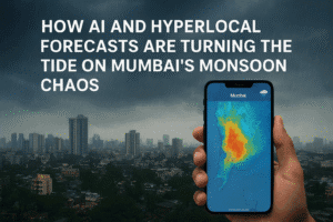
But a quiet revolution is underway. During the relentless rains of August 2025, city officials for the first time wielded a powerful new tool: AI-powered forecasts that could predict dangerous downpours in specific neighborhoods up to three days in advance. This shift from city-wide to street-level forecasting represents a monumental leap in urban resilience for India and a new hope for cities grappling with a climate-changed reality of more frequent and intense rainfall.
From Seasonal Trends to Saving Streets
Historically, Indian meteorology focused on the macro. The primary concern was the broader seasonal monsoon pattern, crucial for the nation’s agriculture. Disaster prevention took a definitive turn after the 1999 Odisha supercyclone claimed nearly 10,000 lives, proving the immense value of early warnings. However, the unique challenge of urban flooding remained.
“The problem in a tropical city like Mumbai is that weather systems can pop up and move very quickly,” explains a climate scientist familiar with the project. Standard global models, with resolutions of around 25 square kilometers, simply couldn’t capture the micro-variations caused by local topography, the urban heat island effect, and coastal winds. Forecasting a city-wide event was one thing; predicting which specific low-lying neighborhood would be underwater in six hours was another entirely.
The devastating Chennai floods of 2015 became the catalyst for change, spurring government funding for advanced urban flood forecasting models. The threat is only growing: data shows that in Mumbai, the average volume of rain on heavy rainfall days has surged from 131 mm (2014-2018) to 182 mm (2019-2025).
The Technology Behind the Warning
The Mumbai project is a collaboration between the Indian Institute of Technology (IIT) Bombay, the regional meteorological department, and the municipal government. The team, led by experts like Subimal Ghosh, took an innovative approach.
They used an AI model trained on years of past global forecast data and hyperlocal data from 36 weather stations across Mumbai. This allowed the AI to learn the complex, hidden patterns that lead to extreme rain in specific locales. After initial fine-tuning to better predict outlier events, the model achieved a remarkable feat during 2024 testing: it provided a three-day warning for every major rainfall event except one.
This year, they integrated this with two other crucial systems:
- Radar-Based “Nowcasting”: Providing a minute-by-minute forecast of rainfall over the next 90 minutes.
- Crowdsourced Flood Monitoring: An experimental website combined data from water sensors with real-time reports from over 100 trained residents, creating a live map of actual flooding.
The human inspiration for this crowdsourcing is telling. During a 2019 downpour, Ghosh found himself relying on a frantic WhatsApp group of parents to track his 3-year-old’s school bus as it navigated submerged streets. This experience highlighted a critical gap between official forecasts and ground reality—a gap the new system aims to close.
The Real-World Impact: Confidence in Chaos
The true test came during last month’s relentless rains, when a month’s worth of water fell in just four days. While the city’s infrastructure was still overwhelmed, the official response was transformed.
With area-specific predictions in hand, city officials like Abhijit Bangar could act with unprecedented precision. Water pumps were pre-deployed to neighborhoods flagged for the heavrain. Most notably, officials made the call to close schools the evening before the worst day, avoiding the last-minute chaos that typically strands children and commuters.
Perhaps even more impressive, the granular data gave them the confidence to reopen schools the next day despite public pressure to keep them closed. “They looked at all the forecasts. They followed the science,” Ghosh noted. The result was less disruption, fewer stranded citizens, and a faster cleanup.
A National Movement with Global Relevance
Mumbai‘s success is igniting a hyperlocal forecasting movement across India. Kerala state has launched community-based flood forecasts in river basins. The national government recently introduced the Bharat Forecasting System, aiming for higher-resolution weather modeling.
The lesson extends far beyond India’s borders. For megacities worldwide—from Jakarta to Miami to Lagos—climate change is manifesting as urban extreme weather. Mumbai’s model demonstrates that the solution isn’t just about building bigger drains; it’s about building smarter information systems. By marrying cutting-edge AI with localized data and human experience, cities can finally move from reacting to disasters to proactively managing them, saving not just lives but the precious economic and social stability threatened every time the clouds gather.

You must be logged in to post a comment.