Heavy Rains Lash Tamil Nadu: 17 Districts on High Alert (Aug 8, 2025)
The Regional Meteorological Centre issued a yellow alert for 17 Tamil Nadu districts—including Krishnagiri, Vellore, Cuddalore, and Nagapattinam—plus Puducherry and Karaikal, warning of heavy rains, thunderstorms, and lightning today. Northern districts like Ranipet and Vellore face a third straight day of severe downpours, with Arcot and Kaveripakkam already recording 9 cm rainfall.
The deluge is driven by three systems: a cyclonic circulation over Andhra Pradesh, a trough from Coastal TN to Sri Lanka, and another over Karnataka. Residents in alert zones should avoid flooded roads, prepare for outages, and clear storm drains. While northern areas battle rain, Madurai hit 40°C—highlighting regional extremes. The next 48–72 hours are critical, with a potential low-pressure system brewing in the Bay of Bengal by August 13.

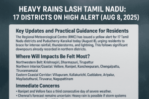
Heavy Rains Lash Tamil Nadu: 17 Districts on High Alert (Aug 8, 2025)
Key Updates and Practical Guidance for Residents
The Regional Meteorological Centre (RMC) has issued a yellow alert for 17 Tamil Nadu districts and Puducherry-Karaikal today (August 8), urging residents to brace for intense rainfall, thunderstorms, and lightning. This follows significant downpours already recorded in northern districts.
Where Will Impacts Be Felt Most?
Districts under alert include:
- Northwestern Belt: Krishnagiri, Dharmapuri, Tirupattur
- Northern Interior/Coastal: Vellore, Ranipet, Kancheepuram, Chengalpattu, Tiruvannamalai
- Eastern Coastal Corridor: Villupuram, Kallakurichi, Cuddalore, Ariyalur, Mayiladuthurai, Tiruvarur, Nagapattinam
Immediate Concerns:
- Ranipet and Vellore face a third consecutive day of severe weather.
- Chennai’s forecast remains uncertain: Heavy rain is possible if storm systems sustain strength before hitting the coast.
- Highest Rainfall (Thu): Arcot & Kaveripakkam (Ranipet) – 9 cm; Ambur, Wallajah, Ammundi – 8 cm.
Why the Sudden Deluge?
Three weather systems are converging:
- A cyclonic circulation over South Coastal Andhra Pradesh.
- A north-south trough stretching from Coastal TN to North Sri Lanka.
- An upper-air cyclonic system over North Interior Karnataka.
Additionally, a potential low-pressure area may form in the Bay of Bengal by August 13, extending wet conditions.
Temperature Extremes Highlight Regional Contrasts
While rains drench the north:
- Madurai Airport hit 40°C (hottest in TN).
- Karur Paramathi recorded 21°C (coolest plains temperature).
What Residents Should Do
- Travel Safely: Avoid flooded roads, especially in low-lying areas like Cuddalore and Nagapattinam.
- Prepare for Outages: Charge devices; store water if in thunderstorm-prone zones (Vellore/Ranipet).
- Farmers: Delay harvests in alerted districts; protect stored crops from dampness.
- Urban Dwellers: Clear storm drains to prevent waterlogging.
Looking Ahead
The next 48–72 hours are critical. While northern districts will bear the brunt, coastal areas should stay vigilant. RMC advises monitoring updates as the Bay of Bengal system develops next week.
You must be logged in to post a comment.