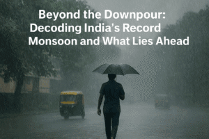
Beyond the Downpour: Decoding India’s Record Monsoon and What Lies Ahead
India experienced one of its wettest August months in over a century, with rainfall ranking as the seventh highest since 2001. The northwest region recorded its highest rainfall this century, driven by a strong monsoon revival in the latter half of the month. This surge was caused by multiple low-pressure systems that sustained intense rainfall for nearly two weeks. The India Meteorological Department forecasts above-normal rainfall to continue into September, benefiting agriculture but requiring continued flood vigilance in certain regions.
However, rainfall distribution will be uneven, with some northeastern, eastern, and southern areas likely receiving below-average showers. The monsoon’s withdrawal is now expected around mid-September, reflecting a broader trend of delayed seasonal transitions. This pattern underscores the growing importance of accurate forecasting for both water management and public safety.

Beyond the Downpour: Decoding India’s Record Monsoon and What Lies Ahead
While many remember August for the fading summer heat, August 2025 has etched its name in India’s meteorological history for a different reason: an extraordinary, record-shattering deluge. The India Meteorological Department (IMD) has confirmed the country just experienced one of its wettest August months in over a century, a phenomenon that is set to extend into September with above-normal rainfall.
This isn’t just a story about higher-than-average rain; it’s a complex narrative of climatic revival, regional disparities, and the growing challenges of weather prediction in a changing climate.
A Month of Meteorological Extremes
The numbers from the IMD are staggering. With a national average of 268.1 mm, August 2025 ranks as the 7th highest since 2001 and the 45th highest since 1901. This national figure, however, masks even more dramatic regional stories.
- North-West India (including states like Punjab, Haryana, Rajasthan, and Delhi) recorded its highest August rainfall since 2001.
- South Peninsular India witnessed its 3rd highest rainfall this century.
This surge wasn’t consistent throughout the month. The first half of August was surprisingly subdued, raising concerns about a weakening monsoon. However, the pattern reversed dramatically from August 14th onwards. According to IMD Director General Mrityunjay Mohapatra, “Active to vigorous monsoon conditions prevailed during the second half… due to the formation of four low-pressure systems with a total of fifteen days.”
These weather systems, which form over the Bay of Bengal and move inland, are the primary engines of intense monsoon rainfall. Their persistence and frequency in the latter half of the month were the key drivers behind the record-breaking totals.
The Forecast: A Wetter-Than-Usual September
The monsoon is not done yet. The IMD projects that September 2025 is “most likely to be above normal” for the country as a whole. This prediction is significant as it suggests a delayed withdrawal of the monsoon rains, a trend that has been observed in recent years.
“This is a crucial extension for the agricultural sector,” explains a senior agrometeorologist, who preferred to remain anonymous. “A healthy September fills reservoirs precisely ahead of the Rabi (winter) cropping season, ensuring adequate water for irrigation and drinking.”
However, the rainfall will not be uniform. While most of the country is expected to see normal to above-normal rain, some regions—parts of northeast India, east India, the extreme southern peninsula, and some northwestern areas—may receive below-normal showers. This uneven distribution highlights the critical need for localized weather advisories for farmers and water resource managers.
Beyond the Rainfall: Temperature Trends and the Cloudburst Question
The press conference also shed light on temperature records, providing a more holistic view of the month’s climate. The average minimum temperature was the 7th highest since 1901, contributing to a mean temperature that ranked 15th highest. This combination of high humidity and warm nights can significantly impact public health and energy demand.
A topic of increasing public interest, cloudbursts, was also addressed. Mr. Mohapatra clarified the scientific definition—a sudden, intense rainfall event of 10 cm or more in a very short duration—and noted that while they are more frequent in hilly regions, they are not exclusive to them.
“Cities like Chennai and Puducherry have experienced these events,” he stated, referring to recent urban flooding. He was cautious, however, about attributing a definitive increasing trend, noting that while some organizations report a rise, the inherently rare and hyper-localized nature of cloudbursts makes long-term analysis challenging.
The Human and Strategic Impact
For the average citizen, this news translates into a few key takeaways:
- Prepare for Persistence: The monsoon is not retreating early. Urban centers must remain vigilant about drainage management to prevent waterlogging and flooding.
- Agricultural Planning: Farmers, particularly in central and western India, can plan for a longer Kharif season but must stay updated on highly localized IMD forecasts to avoid crop damage from excessive rain.
- A Delayed Withdrawal: The IMD chief confirmed the trend of a delayed monsoon withdrawal, now expected around September 17th instead of the historical date of September 1st. This is a clear indicator of shifting climatic patterns.
In conclusion, the record-breaking rains of August 2025 are more than a statistical anomaly. They are a powerful reminder of the monsoon’s inherent variability and intensity. The event underscores the invaluable role of advanced meteorological forecasting in mitigating disaster, managing water resources, and securing the agricultural economy—a sector upon which millions of lives and livelihoods depend. As the rains continue into September, the nation watches, adapts, and learns to live with the new rhythms of an ancient weather system.
You must be logged in to post a comment.