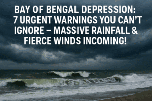
Bay of Bengal Depression: 7 Urgent Warnings You Can’t Ignore – Massive Rainfall & Fierce Winds Incoming!
A rapidly strengthening depression over the Bay of Bengal is set to bring heavy rainfall, strong winds, and coastal disruption to West Bengal, Odisha, and Bangladesh, marking an unusual early-season threat. Centered near Sagar Island, the system is expected to intensify and make landfall by afternoon, prompting serious warnings from the IMD. Coastal districts face isolated extreme rainfall exceeding 204 mm, posing flash flood and landslide risks.
Urban areas like Kolkata and Bhubaneswar may experience severe waterlogging, while maritime activity remains highly dangerous. Authorities are urged to activate disaster response measures, evacuate vulnerable zones, and communicate alerts swiftly. Residents should stay informed, avoid unnecessary travel, and prepare emergency supplies. This rare May depression may signal shifting pre-monsoon weather patterns, raising broader climate concerns. As landfall nears, vigilance and preparedness remain vital across the region.

Bay of Bengal Depression: 7 Urgent Warnings You Can’t Ignore – Massive Rainfall & Fierce Winds Incoming!
The skies over the Bay of Bengal are churning with an unseasonable intensity. A rapidly strengthening weather system, now officially classified as a depression, is poised to unleash significant rainfall and winds upon the coastal regions of West Bengal, Odisha, and Bangladesh, serving as a stark, early reminder of the region’s vulnerability.
The System’s Trajectory and Threat:
As of early morning today, the depression was centered roughly 100 km south-southeast of West Bengal’s Sagar Island. Meteorologists at the India Meteorological Department (IMD) predict it will intensify into a Deep Depression within hours, tracking northwards. Landfall is anticipated by this afternoon, impacting the coastline between Sagar Island (West Bengal) and Khepupara (Bangladesh).
What This Means for Residents:
- Significant Rainfall: The IMD has issued serious warnings:
- Heavy to Very Heavy Rain: Expected across multiple districts in West Bengal and Odisha.
- Isolated Extremely Heavy Rain: Coastal areas face the highest risk of deluges exceeding 204 mm (approx. 8 inches) in 24 hours. This dramatically increases the risks of flash flooding, urban waterlogging, and landslides in susceptible hilly terrain.
- Strong Winds: Gusty winds, intensifying as the system approaches landfall, are likely. While not yet cyclonic strength, these winds can damage temporary structures, uproot trees, and disrupt power supplies.
- Maritime Danger: The sea state will become very rough to high. Fishermen are strictly advised not to venture out. Those already at sea are urged to return to shore immediately. Coastal activities should be suspended.
The Human Impact and Necessary Action:
- Coastal Vulnerability: This early-season system underscores the precarious position of coastal communities. Low-lying areas, especially in the Sundarbans delta region and along the Odisha coast, are highly susceptible to inundation even from heavy rainfall, independent of storm surge.
- Beyond the Coast: While coastal districts bear the brunt, heavy rainfall can quickly overwhelm drainage systems in cities like Kolkata, Bhubaneswar, and Cuttack, causing severe disruption. Inland districts receiving heavy rain also face flood risks to rivers and agricultural land.
- Preparedness is Key:
- Residents: Monitor official IMD, state disaster management authority (like WBSDMAP and OSDMA), and local news updates closely. Secure loose objects, avoid unnecessary travel, especially through waterlogged areas. Charge essential devices and have an emergency kit ready (water, food, medicines, torch, important documents). Know your nearest evacuation shelter.
- Authorities: Swift action is needed to clear drains, preposition disaster response teams (NDRF, SDRF), ensure relief supplies are ready, and effectively disseminate warnings, especially to remote fishing villages and low-lying communities. Evacuations from the most vulnerable areas should be proactively considered.
A Broader Context: An Early Warning Sign?
This May depression is unusual. The main cyclone season typically peaks later (October-November). Its early formation and intensification raise questions about evolving weather patterns. Is this an isolated event, or a signal of changing pre-monsoon dynamics potentially influenced by broader climate trends? While definitive links require scientific study, it undeniably highlights the year-round need for robust disaster preparedness infrastructure and community awareness in this cyclone-prone region.
The Path Ahead:
The immediate hours leading to landfall are critical. The intensity of the rainfall, particularly the location of “extremely heavy” pockets, will determine the level of flooding and disruption. Coastal communities in West Bengal and Odisha must remain on high alert, prioritizing safety and heeding official instructions. This developing depression, though not a major cyclone, is a potent demonstration of nature’s force and the constant need for vigilance along India’s eastern shoreline.
You must be logged in to post a comment.